The city entry was about the shape of the place. This one is about the three things the builder decides last, which are the three things you’ll actually use on the ground.
Where the doors are
The builder decides where every door is, and I care about that more than about the buildings themselves. The front door goes on the wall that faces the street, so it’s where you’d expect it. Most buildings get a back door on the opposite wall too, and some of the tiniest ones don’t, which is the first thing a survivor should check before going in. Big buildings get wide double doors, and a long shopfront gets several. Windows go along the walls between, on every floor, and never on a wall that’s shared with the building next door.
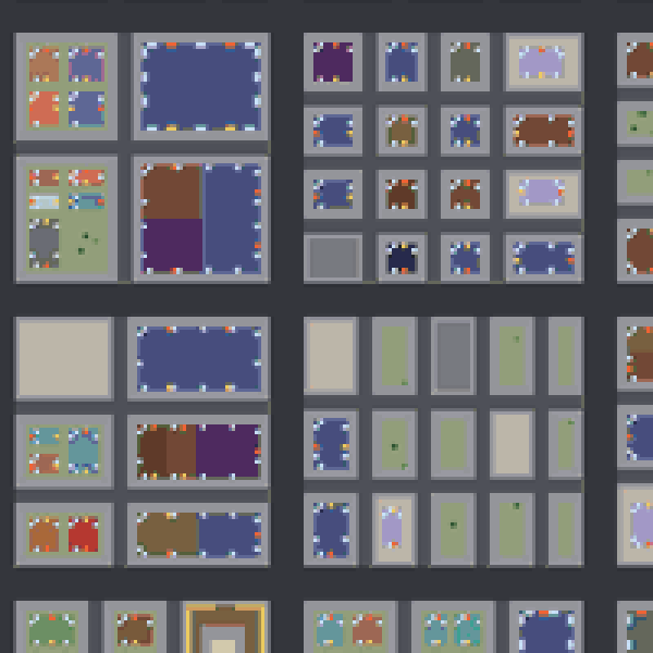
So when you stand in front of a place and count the ways in, the count is real. A corner store with one door and two windows and a mall with six entrances are different problems, and the city made them different on purpose. The buildings entry said a refuge is a blind spot; the number of holes in it is now something you can see from the street.
What the streets are called
Then the city is named. Streets get names, numbered one way and mostly named the other, with a Main Street and a Broadway somewhere in the middle and a route number on the highway. Neighbourhoods grow out from seeds planted where the city is dense, spreading over blocks until they meet on a big road or a river, so the seams fall where a person would draw them. They get names too, the kind a place gets from what’s near it: Riverside, Old Town, Oakwood. Every building has an address, and shops and civic buildings have a name on the front.
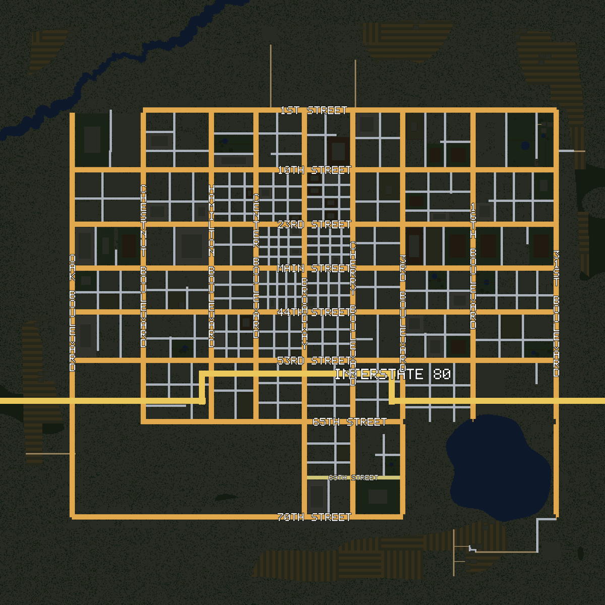
I did this for one reason. This is a game about telling someone where you heard something. “Groan, S” is what the log tells you. “They’re on 4th, by the church” is what a player should be able to tell another player, and you can’t say that about a street with no name.
How many people lived there
Each neighbourhood also has a population: how many people lived and worked there before. It comes from the buildings, floor by floor, so a tower block counts for more than a house. That number becomes the zombies. Where the city was full of people, it is full of the dead now, and a neighbourhood’s number on the map is a fair warning of what’s waiting in it.
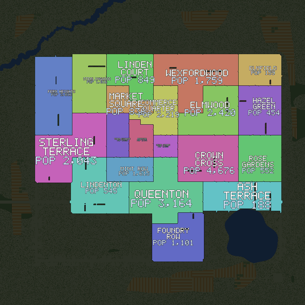
What I look for in the end is whether I could find my way around it. If I can’t point at a picture of the city and say “that’s downtown, that’s the poor side, that’s the way out”, a player on the ground has no chance.